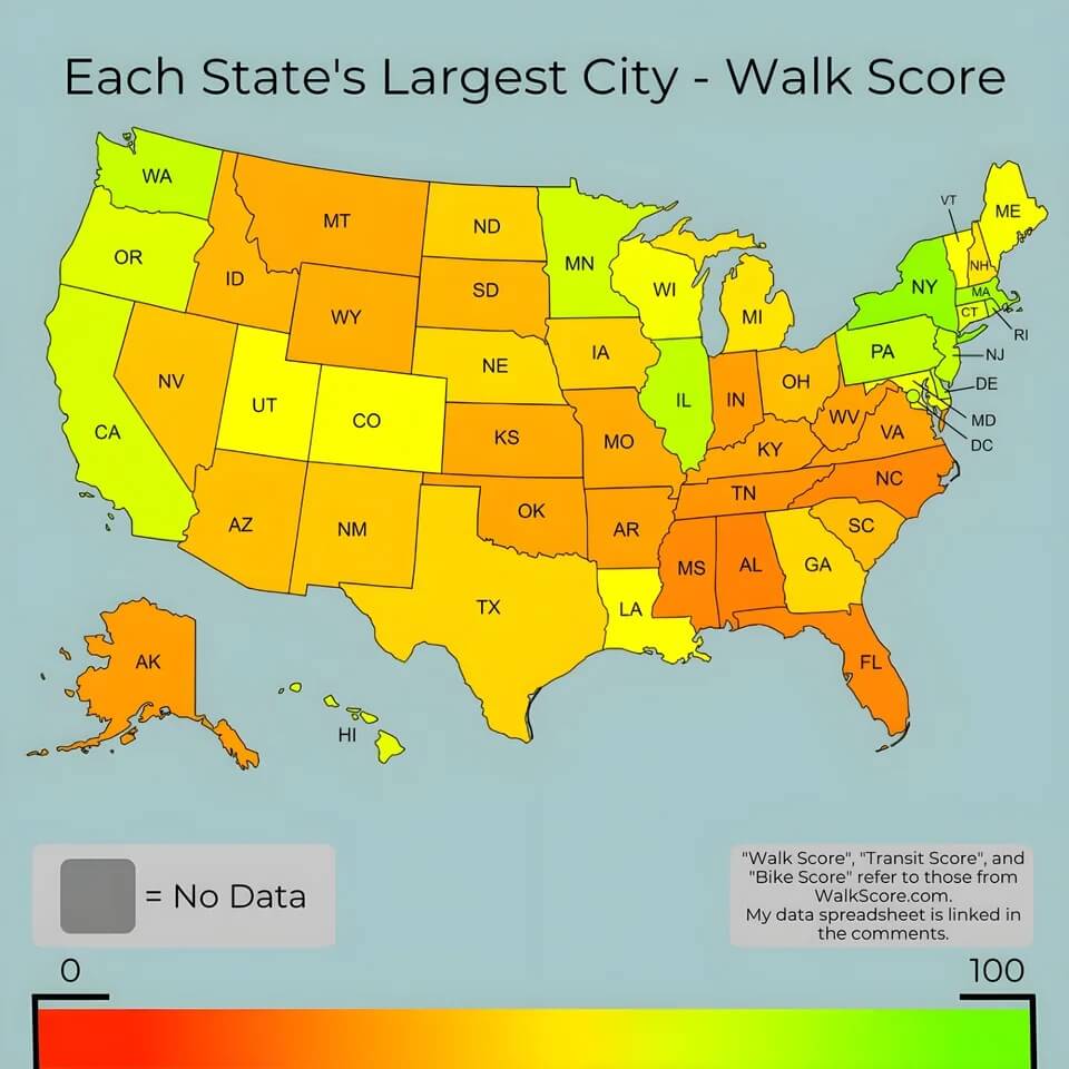
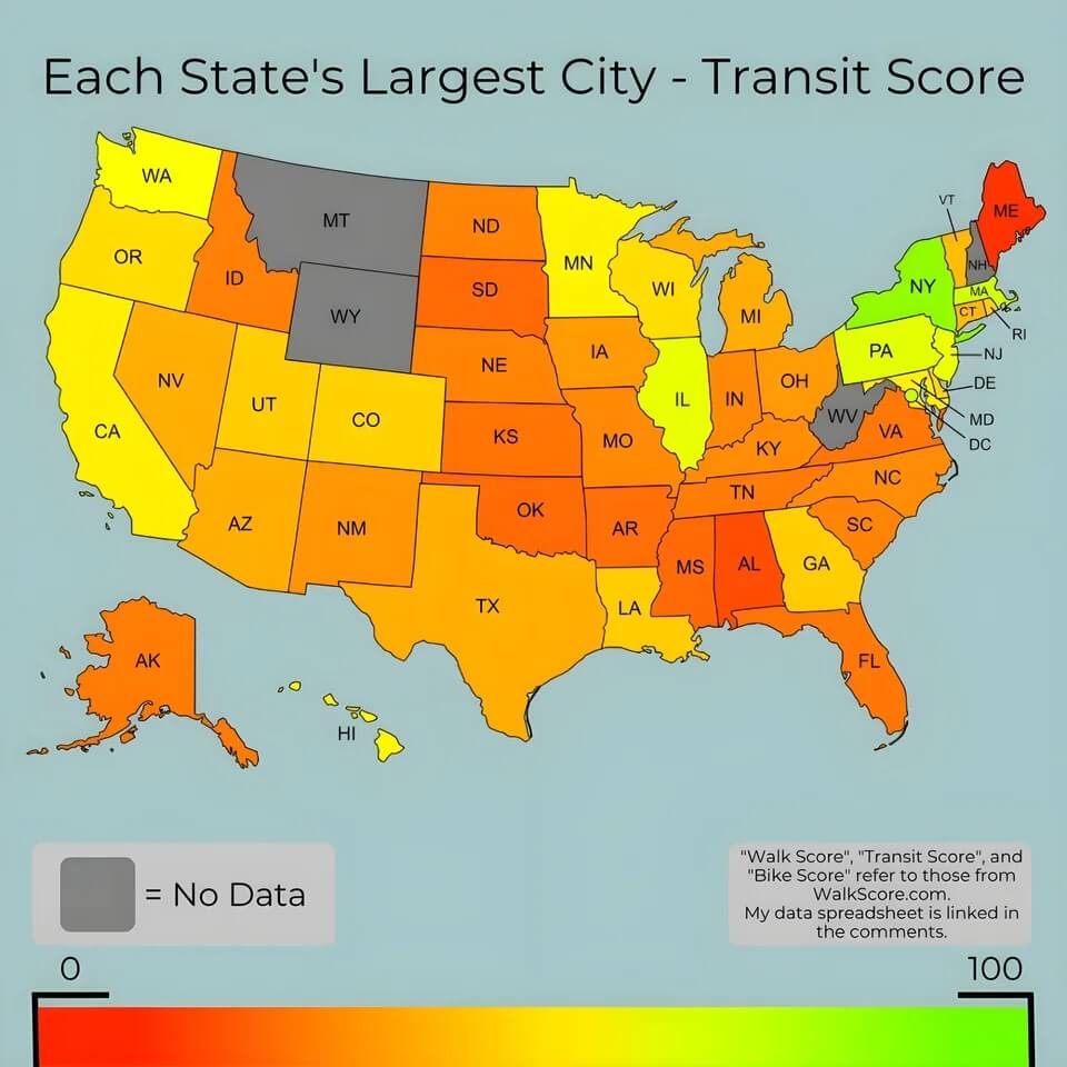
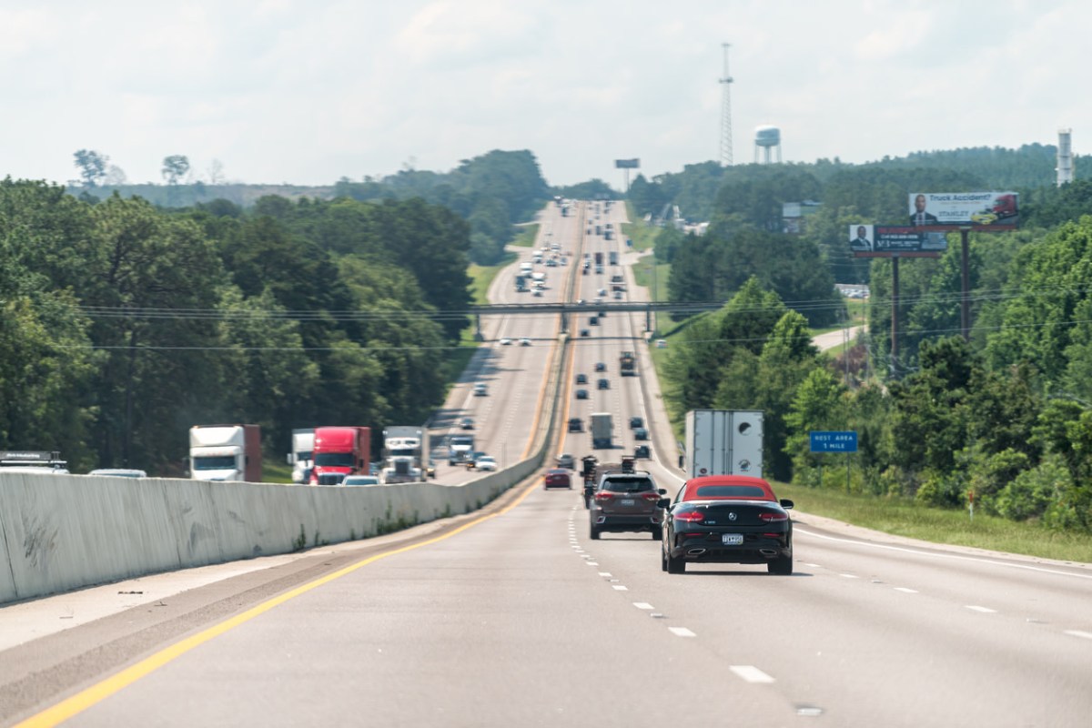
Cars are one of the biggest sources of planet-overheating pollution in our society. According to the EPA, a typical passenger vehicle produces over five tons of carbon pollution per year. And yet, as a series of maps that were recently posted to Reddit show, most major American cities make getting around without a car incredibly difficult.


"I mapped out each state's largest city's walk/transit/bike scores," wrote the creator of the maps.
The maps have each state filled in with the color — on a red-to-green scale — that corresponds with its score out of 100 in each area. The closer to red, the less walkable (or the less bikeable, or the fewer public transit options) that state's biggest city is.
The walkability map shows nearly every city somewhere in the orange range, with only a few (like New York, Massachusetts, and Illinois) in the green range.
The transit map is even worse, with even more orange and several red states, with only New York standing out as green.
The bike map is somewhat better, with more of a mix of green, yellow, or orange. Biking is certainly one of the most environmentally friendly ways to get around, as it produces zero planet-overheating pollution, but it is not possible for everyone — particularly not for people who are elderly or people with physical disabilities.
The commenters on the Reddit thread bemoaned the state of our car-centric society.
"Currently in Columbia, SC and my job is only ~2mi away, but I have to cross 4 large, busy intersections," one commenter wrote.
"Currently stuck in Ohio after living in the [Pacific Northwest] for my whole life," wrote another. "I've been denied jobs at places less than a mile away from where I live on the suspicion that I'd be unreliable because I don't own a car. I hate it here."
Join our free newsletter for easy tips to save more, waste less, and help yourself while helping the planet.


