Floods, fires, and extreme heat can seriously impact decisions such as where you should live and when to evacuate.
Now, the White House, alongside the mapping software company ESRI, has rolled out a tool to help you understand the natural disasters your community might face.
What does the tool do?
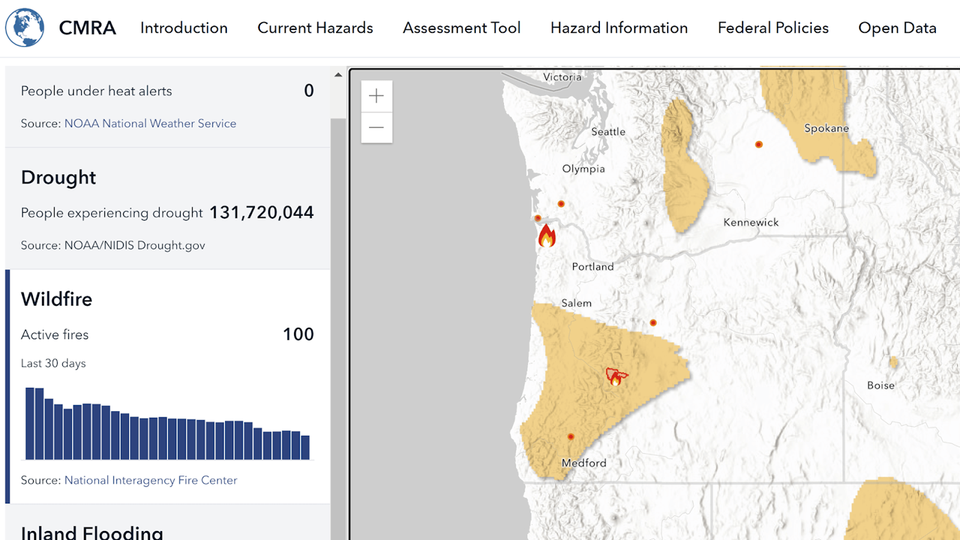
The tool, named the Climate Mapping for Resilience and Adaptation Portal (CMRA), can do just about everything. If you want to look at what disasters are currently affecting a location, you can just type in the address.
CMRA shows you exactly where natural disasters are hitting the U.S. in real time. These disasters include extreme heat, wildfire, drought, flooding, and coastal inundation.
For example, if you want to know where wildfires are burning, you can explore the map, which visualizes all the current fires.

Once you find an area with a fire, the CMRA will tell you how big the fire is, where exactly it's burning, how long it's been burning, how it's affecting the air quality, and where to get more information regarding evacuation.
The CMRA also helps people and communities plan for the future by estimating future climate risks in any given American location. So if you want to see how bad flooding will be at the beach house you're looking at in North Carolina, this tool will give you tons of information.
It can assess environmental risks up to the year 2100 and will give you info based on different projections of how much the Earth will overheat. There's also a user guide to help you get started.
How the CMRA is already helping
The CMRA helps communities make more informed decisions about planning for resilience. Besides providing a ridiculous amount of data, it also has tons of resources for state and local governments, grant officers, and individuals.
Follow The Cool Down on Instagram and subscribe to our newsletter.


